Thursday, May 26, 2011

Life Long Learner Project #3,234,897.09543 (Just Kidding!)

Yes, I was inspired by my mother, some homeschool blogs, and a friend across the world to take advantage of this free time in the summer and help my soon-to-be third grader learn the fifty states. We just finished studying the five regions of the U.S. and I think it's important to know the states and where they lie and, am I dreaming?, their capitals?????  I think not. ;-) Anyways I was bribing my children at the Dollar Tree (Yes, I am a cheap skate!) and ran across a beautiful U.S. map for .....Can you believe it?.... $1. I was ecstatic.  Here was the answer to my dilemma.  Now I didn't have to visit a teacher store. (I live about 40 miles from the nearest one.  Did I mention we live in the boonies?) I didn't have to spend a bunch on educational supplies. You won't either. You probably have every thing you need at home.  I could begin the quest for geographical (domestic anyways) knowledge.  Let me just say, I took the easy route and learned the song......Alabama, Alaska, Arizona, Arkansas, California.......Big Man, however, thinks it's hoakie, IMAGINE.  I digress... Anyways, here's what I did:

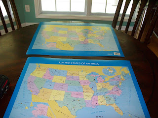
Step #1  I bought two maps.  One to hang on his bedroom wall.  Another to use in our progress.

Step#2   I grabbed our social studies book we are using, and used it to divide the states into the 5 geographic regions.  This will save you time.  Here they are :

Southeast: Florida, Georgia, Alabama, Mississippi, Louisiana, Arkansas, Tennessee, Kentucky, West Virginia, Virginia, North Carolina, South Carolina.
Northeast:Maryland, Delaware, New Jersey, Pennsylvania, New York, Connecticut, Rhode Island, Massachusetts, New Hampshire, Vermont, Maine.
Middle West: Ohio, Indiana, Michigan, Illinois, Wisconsin, Minnesota, Iowa, Missouri, Kansas, Nebraska, South Dakota, North Dakota.
West:Montana, Nevada, Colorado, Utah, Idaho, Washington, Oregon, California, Wyoming
Southwest: Arizona, New Mexico, Texas, Oklahoma
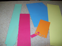

Step #3:  I used five different colors of scrap paper to separate the states into regions.  I chose pink for the southeast, green for the northeast, blue for the middle west, yellow for the west, and orange for the southwest. 


Step #4 I cut the paper into 1/4 inch strips.          


Step #5: I cut the strips to cover the names of states: Some double decker names may need a 1/2 inch strip. Tape the colored paper
over the names so your child can lift the paper to self check as he/she studies.


Then, viola, you are ready to study the Fifty Nifty United States..... sorry, I burst into show tunes often.
                                                                                                                     

Saturday, May 21, 2011

Fallen off the Blogosphere

Yes, I know I have fallen off the blogosphere. But, since, I am my only follower, I think it's allowed.  I have been a thrift queen lately.  I thought I'd share a few finds with you. I visited our local Goodwill lately and came across these two items. The beaded
 jewelry box is sitting pretty in our great room. The tray, while cute will come under glue in a decoupage project soon. I will
 post pics as soon as I get to it. 
The beaded box reminds me of the fabulous beaded pillows I saw at Pier One a few weeks ago.  I aim to craft an adorably cheap and chic imitation this summer. I just love beading on pillows, boxes, clothing, etc. I guess it's the bohemian spirit in me.  Below is the boxes' new home:


As you can see in the pic (left), I love chipboard and acrylic scrapbooks.  Below I wanted to share a new layout I scrapped with the Page Maps book. It is a must have for quick layouts!  If you are interested in the ISBN#, just post and let me know.  My Friend, Amy, and I are hooked.  Ta ta, for now.  Court